FLASHBACK TO FIELD
COURSE: MAY, 1998
GGR 480: Undergraduate capstone course for Geography majors at N.A.U.
Professor George Van Otten
Professor Tom Paradis
Last year's field course included an intensive three weeks of field
trips and projects. We travelled to some very familiar places, and
to some other places "off the beaten path". If there were dirt roads
available, we usually found them. Our trips took us to the Snow Bowl
on the San Francisco Peaks, through Oak Creek Canyon and Sedona, down into
the Verde Valley and Black Hills, onto the Navajo and Hopi Reservations,
and into several small communities including Clarkdale, Jerome, and Camp
Verde. In this year's version of the field class, we may revisit
some of these places, but a very different itinerary is being devised by
Dr. Lee Dexter and myself. Stay tuned for further announcements!
The 11 photos that follow
are just a sample of the places that we experienced, and not all of our
trips are represented here. Still, they may give you a good idea
of the types of activities and discussions that took place during the field
course. Enjoy!
(All photos, except for the first one, taken by Tom Paradis)

Camp Verde, AZ. The entire ggr480
class. Photo taken by Camp Verde Public
Librarian at the end of our
last day "in the field". Proof that everyone did
survive the three-week adventure,
most with smiles on their faces!
Do you recognize any of these geographers?
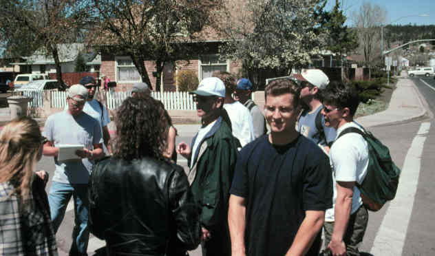
Corner of San Franciso Street
and Butler Avenue, Flagstaff. Dr. George Van Otten,
affectionately known as "Arizona
George," shouts over traffic while discussing the
historical development of "Southside".
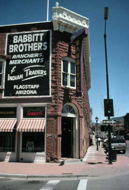
Downtown Flagstaff. Small
towns and cities across the nation are "redeveloping" their commercial
centers through historic preservation, tourism promotion, and theme development.
Students in our class experienced this process up close and personal in
the heart of Flagstaff.
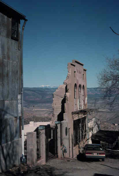
Jerome, Arizona, looking North.
In the 1960s the former mining town of Jerome promoted itself as the "largest
ghost town in the United States". Today that theme persists, although
many community members would like to see the ghost town image disappear
as the town grows once again. Our class examined the derelict landscapes
of past mining activity in the Verde Valley region, and Jerome was a must-see!
(Is that a stratovolcano in the distance?)

Sometimes you have to look carefully
in the cultural landscape to find evidence of community "sense of place".
What does this window sign tell us about Jerome's sense of place?

Creativity abounded when some
of us attempted to understand how this old piece of machinery actually
worked, found now at the Jerome State Historic Park.
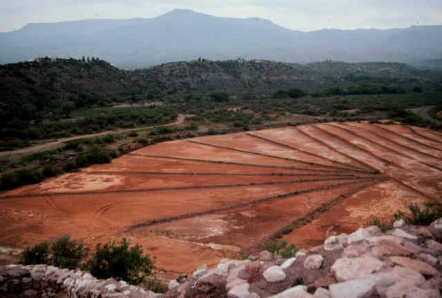
It was not hard to find evidence
of past copper mining activity in the Verde Valley. These copper
tailings, seen here from Tuzigoot National Monument, revealed to us the
importance of environmental sustainability.
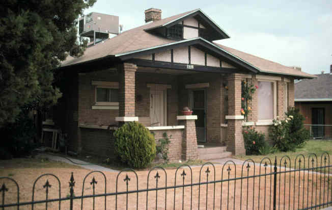
Clarkdale, Arizona. As
a mining company town, Clarkdale was planned all at once in 1914 and was
divided into four neighborhoods: Upper town, Lower Town, Rio Vista, and
Patio Park. We learned how such planning encouraged the segregation of
these neighborhoods geographically, architecturally, and socially.
The most up-scale housing is found in Upper town, represented by numerous
Bungalows and Craftsman-style homes like the one above. Most of the
residential and commercial structures in Clarkdale still survive today.
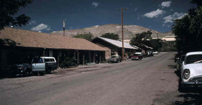
Patio Town, seen above, was
designed to house Clarkdale's Mexican smelter laborers. They were
effectively segregated from Clarkdale's Anglo population up on the hill.
The streets of Patio Town, named Fiesta and Siesta, were oriented
toward the Smelter, seen here in the background.
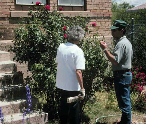
Dr. Van Otten enjoyed talking
with community members. While students were conducting library research
in Clarkdale, "Arizona George" advised this resident with some gardening
tips.
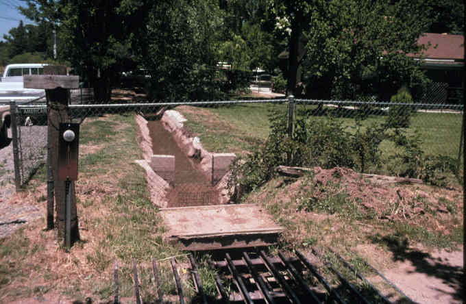
In Camp Verde, we were intrigued
by the irrigation system that had been devised originally for farmers in
the Verde River Valley. Today many of these irrigation ditches are
used to water lawns, like this one just south of the Verde River.

Return to G380
Homepage